Where is Ukraine’s front line? The answer is getting harder, and more political

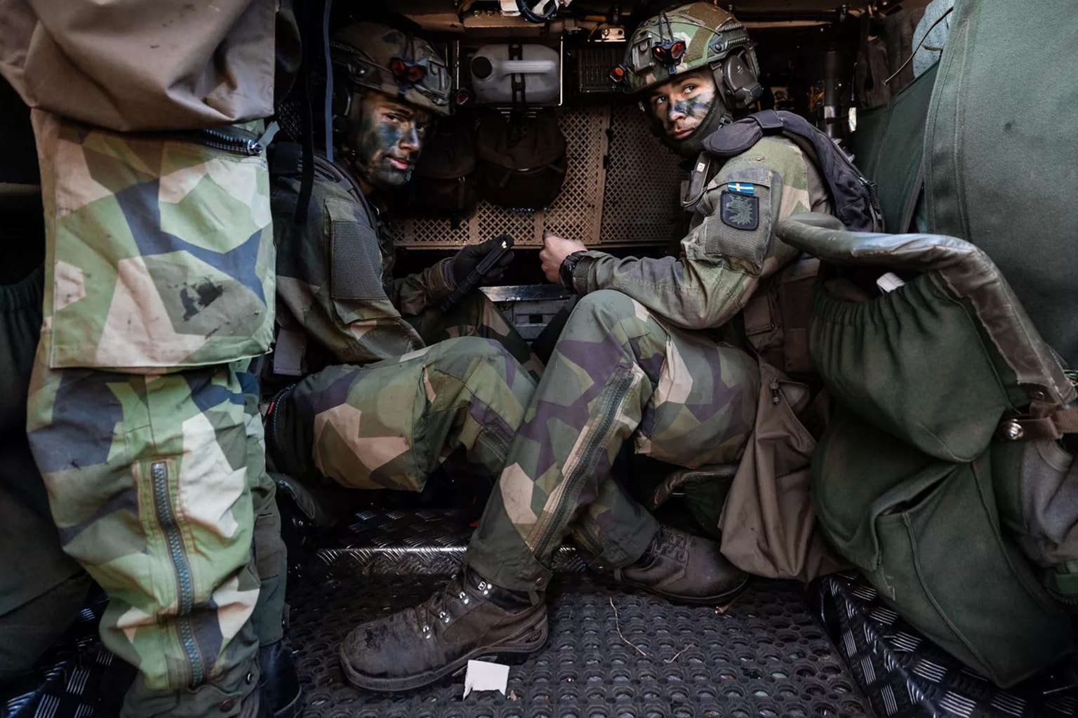
Ukrainian soldiers of the Separate Presidential Brigade “Hetman Bohdan Khmelnytskyi” test a drone designed to hunt Russian drones in Donetsk Oblast, Ukraine, on Feb. 10, 2025. (Serhii Mykhalchuk / Global Images Ukraine / Getty Images)
In the tumultuous history of modern warfare, the information struggle has often been fought with the same fury as the kinetic.
Amid all the attempts to portray success instead of failure, to exude control when there is chaos, there is one hard truth that is difficult to hide from for long: the movement of the front line.
What was — for the entire history of conflict until the last decade — once concealed by the fog of war and hostage to the information politics of the belligerents, is now readily available with a few clicks, thanks to a slew of online maps, reasonably accurate and regularly updated.
When Russia launched its full-scale invasion of Ukraine, the craft of open-source mapping matured from a niche activity and purview of enthusiasts to a driver of international headlines and major troop movements.
Now, with the front line more blurry and the information environment more sensitive than ever, who draws the front line and how has come under increasing scrutiny.
Meet the mappers
Both Ukraine and Russia have their own tactical maps which form the basis of their own everyday operations: for Ukraine, these include maps rendered digitally in battlefield software like Delta or Kropyva.
But in its daily reports on the front line situation, Ukraine's General Staff almost exclusively reports on settlements being liberated, or Russian attacks being "repelled," and almost never that they have been captured.
In this modern trench war, fought in the internet age, the demand to get a fast and relatively accurate understanding of who controls what territory has been met with the help of technology.
One of the first such mapping and monitoring projects, Liveuamap, began its work in early 2014, and soon became one of the prime sources for maps and quick updates on Russia's initial proxy invasion of Donbas that spring, and the subsequent war that ran up until the full-scale invasion in 2022.
Liveuamap continues its work as of 2025, expanding to cover conflicts and other political unrest across the world, but when the full-scale invasion brought more interest to the war, countless more regular mapping projects popped up.
While some maps are published by established organizations like the Institute for the Study of War (ISW), most of those available online come from grassroots open-source intelligence and analysis (OSINT) collectives, like the Finland-based Black Bird Group, whose members are often quoted in international media.

The acts of mapping the battlefield and understanding it come hand in hand, as analysts rely on maps to identify developments and trends, while for those updating the front line, understanding the nature of the fight is key to informing where and how the lines are drawn.
"To actually map these events is an important part in the process of even understanding general dynamics and trends on the ground," Black Bird Group member Emil Kastehelmi told the Kyiv Independent.
In this war of drones and social media, the most timely sources are often videos of Russian or Ukrainian soldiers on the ground, often taken by drones, that are uploaded to Telegram or other platforms, from where they are geolocated.
Some maps, like UAControlMap, also include clickable dots with direct links to the original source.
These data points are then cross-checked against official and unofficial statements from both sides of the front, as well as satellite imagery.
"These maps should be looked at as a simplification of the situation," added Kasthelmi, "it's just like a general visual assessment, it isn't trying to be a carbon copy of Delta."
Over the course of the full-scale war, one Ukrainian mapping project has risen to become the undisputed leader, and in doing so, one of the most trusted sources on front-line developments: DeepState Map.
Founded by Roman Pohorilyi and Ruslan Mykula on the first day of the full-scale war, the map — now available on both browser and a mobile app — has undergone frequent updates, with tools allowing users to track the movement of the front line over time, see Russian deployments, and measure distances.

Thanks to its base inside Ukraine and its prominence in the domestic information space, DeepState is largely unique in that its mapping is also informed by the project's own inside sources from Ukrainian units all across the front line.
As the war ground on over 2024 and 2025, Russian advances picked up and with it, so did criticism of the military leadership and its information strategy.
In this climate, DeepState's map updates, backed by regular objective analysis of the battlefield by Pohorilyi and Mykula posted on the group's Telegram channel, became a uniquely trusted source for Ukrainian society.
For both DeepState and other pro-Ukrainian OSINT projects, operational security plays a major role in the way the battlefield is mapped, with no attempt made to draw individual positions.
"From the viewpoint of informational hygiene, it's good that we can say that our map assessment is based on open sources," said Kastehelmi, "it shows we are not revealing anything that we shouldn't be."
According to several Ukrainian commanders who spoke to the Kyiv Independent, DeepState Map updates tend to come 2-3 days after developments on the ground.

Blurred lines
Already far from an easy task, mapping the battlefield in Ukraine has been made particularly difficult throughout 2025, as the front line itself gets more porous with every month.
One of the first to raise the issue was Deep State, which in March quoted a military source of theirs comparing the situation in the city of Toretsk in Donetsk Oblast to a mixed "salad" where an actual line of contact didn't exist in practice amid the chaotic urban fighting.
This shift has come about thanks to two primary battlefield trends, both connected to the increasingly dense and deep "kill zone" created by both sides' steadily growing reconnaissance and strike drone capabilities.

First, Ukraine's chronic manpower crisis has meant that infantry positions in 2025 are fewer and much further in between than in previous years, with some commanders reporting large areas of the front manned with no infantry at all.
Meanwhile, in a response both to Ukraine's mostly-effective drone-based kill zone and the growing holes in Kyiv's lines, Russia has almost completely shifted to using small group infantry assault tactics rather than large-scale mechanized attacks with tanks and other heavy armor.
Moving forward in groups of one to three soldiers, and with an emphasis on camouflage, these Russian assault teams are often not ordered to assault the first Ukrainian positions they come across, as would be expected in a traditional positional engagement.
Instead, they often infiltrate further, looking to attack Ukrainian drone teams and cause overall chaos, creating sectors where both sides' infantry find themselves holding positions behind each other's lines.


"This (blurring of the front line) has been going on for a while now, and yes, it has really changed our work," DeepState co-founder Roman Pohorilyi told the Kyiv Independent.
"When videos show up of Russian soldiers running in and raising their flags in the Ukrainian rear, all kinds of channels, Russian and Ukrainian, think that if there is video proof, they can redraw their maps accordingly."
Most maps, including DeepState's, show a so-called "gray zone," a contested area in between territory assessed as firmly Ukrainian or Russian controlled.
But whereas previously this gray zone usually corresponded to the "no-man's land" between the two sides' first lines, now it often depicts the wider "contact zone," dotted with overlapping positions.
Over 2025, Russia's infiltration tactics have often manifested on the DeepState map as increasingly jagged and unusual formations, both in the Russian-controlled and gray-painted areas.
For Kastehelmi and Black Bird Group, control is often assessed with a relativist approach.
"When we paint an area as Russian or Ukrainian-controlled, it's more like here the Ukrainians or Russians generally have more control than the other side."
Game of flags
With both sides in the war looking to project an image of their own success and the futility of the enemy's efforts, the idea of control of territory is hotly disputed in the information space.
In this environment, maps of the front line — whether official or independent, whether they like it or not — become an integral part of the information fabric of the war.
In just one typical case, when Russian president Vladimir Putin claimed in October this year that both Pokrovsk in Donetsk Oblast and Kupiansk in Kharkiv Oblast were surrounded by Russian forces, it was online maps like DeepState's that could quickly prove him wrong.
As Russia advances across eastern Ukraine, the first geolocatable instances of Russian troops entering a settlement are often drone shots of soldiers holding a Russian flag among the ruins.


This practice, while often carrying a powerful emotional effect for each side, does not correspond to territorial control, as the soldiers raising flags could be part of a forward infiltration group, and — very often — are quickly liquidated by Ukrainian drone teams or clearing squads on the ground.
"We cannot react emotionally or quickly, or when we see Russians with flags there, we draw, mark, and write something," said Pohorilyi.
"We need to find out more: Whether they have dug in, whether they are alive or have been killed, what the situation is there, whether the Russians can reinforce the area, or whether it is just a one-off group."
While Russia looks to manipulate maps with flag-raising stunts, the leadership in Kyiv — on the defensive and famously prone to denying negative developments — often finds itself at loggerheads with the reality shown by the maps.
The most dramatic example came in August, when Russian infiltration groups pierced over 15 kilometers through Ukrainian lines near the city of Dobropillia in Donetsk Oblast.
When, on Aug. 11, DeepState drew two huge red prongs driving north in the area in their map update — itself an estimation of a dynamic situation on the ground — the military claimed that it was nothing more than a few Russian scouts and sabotage groups, urging the public not to believe third-party maps online.
On the ground, the Russian infiltration had begun in earnest a couple of days earlier, but in a military often plagued by the problem of false reporting, the truth was not making it out, neither to the high command, nor to the public.
"We communicated, saw that there was a problem, began to investigate, spent the whole day communicating with the military, gathered all the information, and then it appeared on our map," Pohorilyi said of that dramatic day.

But while the high command's words downplayed the seriousness of the situation, their actions told the opposite story, as some of Ukraine's most elite units, including the Azov Corps command, were rapidly redeployed to the area.
"The initial communication in this situation from certain spokespeople was as funny, strange, and stupid as possible," Pohorilyi said.
They came out and said that only 5-10 Russians had slipped through, and then the next day the corps announced that they had killed 150 Russians."
Speaking to the Kyiv Independent on the condition of anonymity, one Ukrainian battalion commander fighting in the area at the time agreed that without the role of DeepState's timely and dramatic map update, the necessary reaction from the higher command would have come later than it did.
Love of the counterattack
In autumn, even after the Dobropillia breach was brought under control, two more worrying hotspots on the front line brought more attention to the increased difficulty and sensitivity of the mapping problem.
Russian forces' penetration into the city of Pokrovsk — consistently the site of the hottest fighting in 2025 — became a lightning rod of information warfare, as both sides devoted extra attention to what would be the largest Ukrainian city to fall since Bakhmut over two and a half years earlier.
The battle was defined by two clashes on the information front — the status of Pokrovsk itself, which was being slowly overrun by Russian assault teams, and the threat of a potential operational-level encirclement of the sister city of Myrnohrad and its surrounding villages.

On Nov. 22, as Russia's swallowing of Pokrovsk and likely encirclement of Myrnohrad were looking close to complete, the General Staff published a map of the sector that seemed to be from several months earlier, with Russian-occupied territory far outside both cities and equally far from an encirclement.
Meanwhile, Russian gains sped up in the wide open fields in the east of Zaporizhzhia Oblast, bearing down on the front-line outpost of Huliaipole as an understrength Ukrainian defense fell into a state of chaotic retreat.
In both areas, in a response seen to be typical of Commander-in-Chief Oleksandr Syrskyi's leadership, Ukraine has deployed units of its controversial new Assault Forces to counterattack.
In Pokrovsk, in an operation that blatantly prioritized narrative over military logic, soldiers of the 425th Assault Regiment drove into the city's gray zone to plant a Ukrainian flag on the council building on Nov. 6.
These were not the first such operations: over summer and autumn, several villages were claimed "liberated" or "cleared" by Kyiv thanks to the assault regiments, when in reality, little to no territory was firmly regained.
"There were moments when it was clear that we were not responding (to the General Staff's announcement), and this is testament to our objectivity," said Pohorilyi.
"The flag was raised in the gray zone, and the next day the Muscovites carried out assault operations."

As the situation deteriorated further around Huliapole over November, the dissonance between the maps' updates and the official reports from Assault Forces commander Valentyn Manko about villages being cleared and liberated reached absurd levels.
Finally, in a rare admission on Nov. 11, military spokesperson Vladyslav Voloshyn reported that Ukrainian forces had had to withdraw from five unspecified villages in the area.
"One of the biggest problems with these kinds of statements is that they seem to be intentionally vague," Kastehelmi said.
"They (the General Staff) may not show maps of these developments, and it also helps them to avoid critical questions in the current information space."
Ultimately, as the front-line situation remains precarious and dynamic for Kyiv, the active role played by mapping projects, particularly DeepState, in bringing objective ground truth to the world is here to stay.
"On the one hand, it's great that we have this opportunity, trust, reputation, and that we were able to prevent all this, to draw attention to it," Pohorilyi said.
"On the other hand, it is nonsense when projects like ours are needed to talk about these problems and prevent catastrophic consequences in this way."
Note from the author:
Hi, this is Francis Farrell, cheers for reading this article. This November marks the Kyiv Independent's fourth birthday, and once again it's coming at a tumultuous time on the front line, domestically, and internationally. It's getting a lot more dangerous for journalists, but while large foreign media outlets have stopped going, we will continue to work everyday to bring the battlefield to you. To be able to do that, we are launching a campaign to hit 25,000 members so that we can keep doing what we do. Please consider supporting our reporting.